ArcGIS Online

2022 ArcGIS Online Competition

Posted on

Our friend Charlie Fitzpatrick, the K-12 Education Manager for Esri (the company that produces ArcGIS), reminded us that this year’s ArcGIS Online Competition for US High School and Middle School Students is underway. Students in grades 4-12 who wish to participate must submit entries via their own login in a school/district ArcGIS Online Organization. The […]

ArcGIS Online

GoMap Twenty-One Winners Announced

Posted on

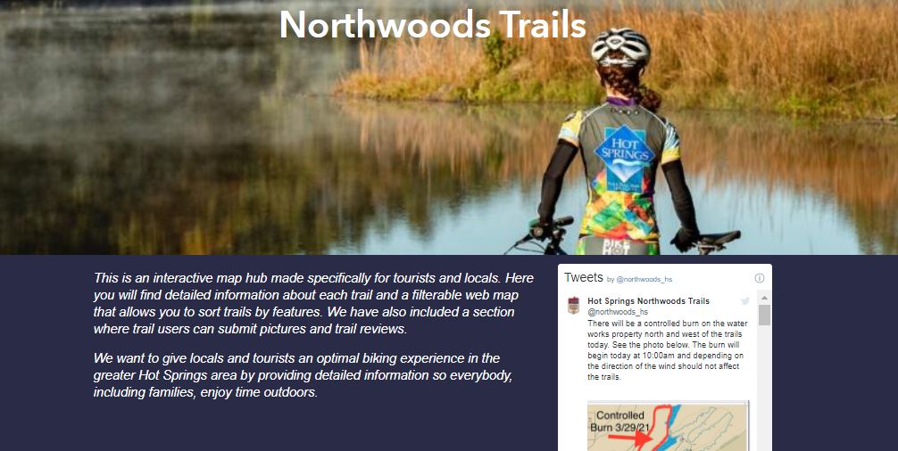
The 2021 GoMap Twenty-One competition winners are from the Hot Springs Junior Academy in Hot Springs, Arkansas! The EAST Geospatial Support Team at the University of Arkansas are extremely proud of this dynamic duo of ArcGIS platform users. Mimi Reagler and Natalie Comstock used teamwork to complete an impressive amount of ArcGIS online training, coordinate […]

ArcGIS Online

Today is Earth Day 2021!

Posted on

One way to celebrate Earth Day (today) is to review this REAL-TIME ArcGIS dashboard of important Environmental Health indicators of our planet! It leverages LIVE data feeds from the ArcGIS Living Atlas! April 22, 2021 – Earth Day Esri has gathered near real-time information within the ArcGIS Living Atlas from many data-contributing partners such as: […]

ArcGIS Online

Mapping WiFi in Arkansas

Posted on

You can use our Public Survey123 application to contribute Public or Free WiFi access locations within Arkansas.   These Free Wifi locations are shared with Arkansas Public School students and citizens that may not have internet access at home.  Your assistance may help Arkansas students or their families locate free internet access nearby! Over 148 Wifi […]

News

Animal Tracking in Potter County, PA – An ArcGIS Storymap

Posted on

We recently discovered this great Animal Tracking tutorial from Potter County, Pennsylvania and thought it may inspire others to leverage ArcGIS Storymaps for conservation within k-12 education. EAST programs are encouraged to empower their community leaders and citizens using their technical capabilities. ArcGIS Storymaps are a very powerful communication tool, and we’re here to help […]

News

Online Historic Maps (1882-2006) – ArcGIS online has them!

Posted on

The ArcGIS Online US Geological Survey (USGS) topographic map collection now contains over 177,000 historical quadrangle maps dating from 1882 to 2006. The USGS Historical Topographic Map Explorer application brings these maps to life through an interface that guides users through the steps for exploring the map collection: Find a location of interest. View these historical topographical maps. Compare […]

News

2020 EAST Conference – Mapping Competition Winner announced

Posted on

The 2020 EAST conference was unfortunately cancelled due to Covid-19 this year but many presentations and competitions were held online/virtual. We’re happy to share this years winner of the Mapping Competition that was sponsored by the Center for Advanced Spatial Technologies (CAST) at the University of Arkansas. We firmly believe in and support our local […]

News

Welcome!

Posted on

Welcome to the EAST GeoTalk blog! This serves as a forum for the EAST Geospatial Support Team to share news, tips, and tutorials in the world of geospatial technologies. The primary authors are Brian Culpepper and Malcolm Williamson, both from the Center for Advanced Spatial Technologies at the University of Arkansas. We will try to […]